Sunday, 2 September 2012

Coming home


We flew back to Rockhampton on Wednesday 22 August after Muriel's funeral, reprovisioned the next day and headed out of Rosslyn Bay Harbour for Sea Hill and the Narrows on Friday 24 August.  We got the top of the tide in The Narrows and continued through to Black Swan, just north of Gladstone. 

This was where we were fogged in on the way up.  High tide was at about 0900 the next morning and we planned to be through Gladstone Harbour while the tide was still going out.  That required a pre dawn start. We woke up at 0520, and we were fogged in yet again! 
  
Fortunately the fog started lifting and there was enough visibility to get away by 0625.  With all of the passenger and construction traffic in Gladstone Harbour, we needed to be seen and be able to see them.  By 1345 that day we were at anchor in Pancake Creek, our intended destination. 

As we intended to move the next day, we anchored in the outer anchorage. The leads and beacons into the creek are only lit at the entry to the creek.  It does not have a bar, so as long as we did not have a relatively strong wind against the tide, we could leave as early as we liked.  The destination was Burnett Heads - 67.2 nautical miles from anchorage to anchorage.  We left next morning at 0345.  This was Sunday 26 August and Burnett Heads was a long way away.  The wind was coming from where we wanted to go so it was a motoring day.  We used both motors for the whole trip and got into Burnett Heads at 1440. 
The weather report for Monday was for stronger wind on the nose again, so we had a rest day in the Burnett River that day and did the washing. 

On Tuesday the weather was forecast to be southerly and south-easterly supposedly going east to north-east in the afternoon.  We set off for Rooney’s Point on the inside top of Fraser Island.  It was a fabulous day for a sail and we sailed close hauled under main, headsail and staysail and ended up about 4 miles off the direct line route because we could not sail directly to where we wanted to go.  So, four miles out, we dropped the sails and motored in.  We were heading for the northern side of Rooney’s Point as the wind had stayed from the south east and this would give us a sheltered and quiet anchorage.  We were focussed on the depth as we crossed Ferguson Spit which has accreted north from Rooney’s Point.  Chris was on the helm and yelled, “What’s that – rocks?” and immediately turned away from the dark shapes in the shallow water.  “No, it’s whales!” Robyn eventually replied in what seemed like minutes.  Four hump back whales were cruising along the line between the deep water and the sand bank.  They completely ignored us and continued to cruise by.  The Wildlife Service warnings to Mariners tell us to keep 100 metres from whales, and do not approach them from directly in front or behind.  When they approach us, it sure gets the adrenaline going!  
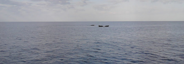
Whales just playing about - tail flukes on the closer one
Rooney’s Point is magnificent.  The beach is long and the sand is a beautiful pale yellow. At night, the loom of Sandy Cape lighthouse is visible from the anchorage.  We had Rooney’s Point to ourselves. We registered another “next time” for a walk on the beach here too.  Come Wednesday, we were on the go early to see Wathumba Creek at low tide and then to Moon Point for the night.  The Fraser Island coast is really beautiful – as good as the top of Moreton Island only more remote and with far fewer boats. 

Rooneys Point
Maripi was again visited by whales when anchored at Wathumba Creek.  She was one of 3 boats “inspected” by a group of 4 whales.  One rolled over and swam on its back for a while.  It was all white underneath.  Two came back to have another look at Maripi and then they moved on.  That day any time we looked for whales we could see some.
Whales at Wathumba Creek
Whales off the stern of Maripi
At Moon Point we were back at the start of the mangrove ecosystem and moving away from the long sandy beaches.  In Great Sandy Straits, we were again working with the tides and rode the incoming tide to the cross over point at Moonboom Island and then the outgoing tide to Garry’s Anchorage.  The anchorage was rough in the northerlies, so rather than stay a few days there waiting for a favourable weather forecast to cross the Wide Bay Bar, we moved on to Kauri Creek the next day, Friday 31 August.  “Catalina”, a Rogers catamaran made the same decision and once in Kauri Creek we caught up for drinks that afternoon.  We knew many people in common and their visitors live a Scarborough.  “Mistweaver” is at Tin Can Bay, so we have talked to Dan on the radio.
Sunset at Kauri Creek

Houseboats at Kauri Creek
Father’s Day is our last day in Kauri Creek and we plan to head out of the creek and over the Wide Bay Bar on Monday morning’s high tide.  The wind and swell are favourable and we will stay in the lee of Double Island Point on Monday night.  We will set off early on Tuesday for Mooloolaba.  Then home on Wednesday.  The forecast is good to do this so maybe it will unfold as we plan!

Hexham Island and The Percys


We set sail under spinnaker for Hexham Island and Stargate was also going there.  Wayne took the great photos of Maripi taken on the 14 nautical mile sail from Cape Townsend.  We saw whales in the distance as we headed for the bay on the northern side of the Island.  It is beautiful, although, with the residual swell was not a wonderful anchorage.  We walked up the hill to the ridge top where we could see The Duke group of Islands, The Percy Islands and back to Cape Townsend. 

Maripi under Spinnaker taken from Stargate
Hexham Island
Hexham Island Anchorage
The next day we moved on to the Middle Percy Island.  We experimented with the tides – who can figure them out in this area – leaving just before first light.  We motor sailed again and the short 23 mile trip only took a few hours.  There was still some swell running so we decided to go into “the Boat Harbour” at West Beach. Like Leekes Lagoon on Great Keppel Island, we dried out two hours after high tide. A comfortable night sleep.

Middle Percy Boat Harbour at half tide
Middle Percy Boat Harbour at low tide
 Middle Percy is a gathering spot for cruising yachties.  Middle Percy is a National Park, except for 15% of the Island which is leased.  The lessee and volunteer yachties have built an ‘A’ frame building which houses memorabilia from passing yachts.  The BBQ was put to good use when the word was circulated that there would be an evening BBQ at the ‘A’ frame at 1700.  17 yachties, one local and a baby goat called “Bob” attended.  Like many other islands, goats were put on Middle Percy to provide food for ship-wrecked sailors.  Without natural predators the goat population exploded and overgrazing damages or destroys vegetation and the land degrades.  There were Notices to Mariners a few months ago to say there would be goat culls on a couple of the Islands in the Whitsundays that have unsustainable feral goat populations.  Despite his fascination with the fire, Bob was destined to be a pet.  Two yachties had brought in their guitars and we sang along to a range of music, dominated by Australian folk music. 

Middle Percy tree house
Bob the goat

Middle Percy A Frame building
Bob
Bob loves the fire

Boats at anchor at Middle Percy
We walked up to the homestead by the track through the mangroves.  Robyn has developed the technique of walking in the footprints that Chris makes so that if it gets soft underfoot, Chris has already compacted the mud/sand for her.  Named by Captain James Cook, Middle Percy Island has a long and colourful history with escaped convicts from Tasmania probably being the first European residents.  

Robyn walking to the Middle Percy homestead
Robyn and Bronte who adopted us
Entrance to Middle Percy boat harbour at sunset
In the Lagoon, we saw Robyn’s Coast Guard team mate, Jeremy who was in the crew delivering Pure Adrenaline from Cairns to Brisbane. It’s a small world.  

This was as far north as we were going.  Our furtherest north was 21 degrees, 36.939 minutes as we rounded the northern most point to Middle Percy.  Maripi’s pontoon in the Newport waterways is at 27 degrees 12.777 minutes latitude and 153 degrees 5.34 minutes longitude.  The furtherest west we got was 150 degrees 14.031 minutes as we came up the western side on Middle Percy to go into the Boat Harbour. 

We left the Boat Harbour on the turn of the tide on Saturday 4 August 2012.  We needed a high tide to get into and out of the Boat Harbour.  We had a fabulous motor sail around the northern, eastern and southern sides of Middle Percy en-route to North West Bay at South Percy.  The beach was beautiful and we enjoyed what turned out to be the last beach walk of the trip except for Fraser Island.  We saw some whales on this trip.  

South Percy
South Percy North West Bay beach
Maripi at anchor at South Percy. Middle Percy Island to the left.
Robyn and Mini Maripi on North West Bay beach
The next morning we were up early for a very pleasant motor sail to Cape Townsend.  After that, we planned to do the next leg to Pearl Bay and as we were making such good time close hauled (into and as close as we could sail to the direction that the wind was coming from) we pushed on to Freshwater.  

We had to tack so we travelled further than if we had motored in a straight line.  Freshwater is a beautiful anchorage and we got there too late to enjoy a stroll on that beach.  

We were pretty tired after the long days and early starts and we were making good progress towards home.  At Freshwater we received a phone call from Ray, Chris’ brother who we had seen in Yeppoon, to say that their mother Muriel was very unwell.  We continued on to Yeppoon the next day which was Wednesday 8 August. On Thursday we hitched a ride to Noosa with Carol from Nardu who was back travelling from Rosslyn Bay to catch up with her family at Tewantin. We then caught the Greyhound backpacker (not so) Express back to Brisbane  The next day we drove to Alstonville to find Muriel awake although weak.  Aged 93, Muriel Florence Mortimer passed away a week later.  Her older brother Don and twin sister, Winifred are both still alive.

Tuesday, 14 August 2012

Island Head Creek and Cape Townsend


It was an early start out of the marina on Tuesday morning.   We were bound for Port Clinton.  The wind was square behind us – again!  This time there was too much for the spinnaker so we sailed with just the headsail and with the wind behind, it was slow so we started a motor and motor sailed.   The seas were reasonably big at 2 metres, so Maripi was doing the diagonal jiggle that catamarans do so well!  We passed North Keppel Island, off to seaward by about 10 miles, then Corio Bay, Five Rocks, Stockyard and finally we were at Cape Manifold. 

Cape Manifold
It was the eastern most point on the trip, so we had to get around it continue northwards.  Manifold Island lies off the Cape and there is good water between it and the Cape.  The water is very deep and in the restricted passage, the seas are very confused.   Once we got through there, the seas calmed noticeably and the sail was really pleasant.  Soon after that we where off Cape Clinton and could turn into the huge harbour that is Port Clinton. 
Port Clinton at sunset
The best anchorage is on the eastern side of the waterway, under the hills that form the eastern edge of Port Clinton.  The anchorage was adequate but the beaches nearby were rocky and not inviting.  Instead of staying 2 nights as planned, we moved on the next day.
Our tender “Mini Maripi” is 2.4m long and is powered by a 3 hp outboard.  It is small so that we can manage lifting it up on the deck to be stowed for passages.  It is very reliable but the small size keeps us mindful of the conditions (wind, tide and sea state) and determines how far we go from the big boat. 
We left Port Clinton at 0900 and had the sails up before we were out of the sheltered water.  The weather was excellent and the swells a mere 1.5m.  We sailed past Delcomyn Island and Pearl Bay and took the recommended track into Island Head Creek.  All went well.  We caught up with Merv and Maggie on Ngkala again.  They let us know that the mouth of the creek was the only place we were likely to get phone/ email/Internet coverage.  So we anchored near them and checked all messages and let the families know that we were going out of range for who knows how long!!  Then we moved south into a tributary of the creek and found a great spot with enough water and a headland that gave us protection from winds from the south east to northerlies.  An isthmus about 0.5 miles away protected us from the rest.  We put out a stern anchor to keep us in the hole we had found. Robyn read about Island Head Creek some 30 years ago and a trip to it was on her “bucket list”.  It was beautiful.  While it too had rocky headlands and mangroves, there were also some really beautiful beaches.  We had many dingy trips to the isthmus where we could walk over to the sandy beaches.  

Maripi and Stargate in Island Head Creek
Stargate
Stargate in Island Head Creek

Maripi in Island Head Creek
One morning a dugong was grazing less than 5 metres from Maripi .  It came to the surface twice and was not disturbed by our presence.  We saw it again a couple of days later but about 300 metres off from the dingy.   After 4 nights at that anchorage we headed up to the end of the creek but stayed only one night.  In a remarkable coincidence Mark who we had met at Living Valley Spring Health Retreat in February 2011 was at Island Head Creek with his family when we were there.  We were invited onboard Ashlynn to meet the family and enjoyed fresh mud crab.  Later in the day we went with Mark and the kids and checked the crab pots.  The mud crabs are HUGE there and we got 5 large ones.  They gave us a cooked crab that had only one claw.  These are of no use in their Japanese restaurant in Yeppoon. 
Paddy, Ashlynn and Mark from Ashlynn
Crab!!!
We also traded a date loaf for several black bream, delivered over a few days by our neighbours, Steve and Wayne on Stargate, a 10 metres Rogers Cat.  There is no sign of the Army’s activities at Island Head Creek despite the creek being in the Military training area.  At the next stop , Cape Townsend, there is a sign that can be read from about a mile away saying ”Danger bombing range”, although  there were no signs of the recent exercises in the area.  The beach is a long and punctuated with rocks.  There are many more rocks evident at low tide.   
 
As we sailed up from Island Head Creek we passed Strong Tide Pass.  The tides here are huge, producing set and drift of 2.5 to 3 knots.  We were there with spring tides (full moon) so the tidal range was extreme.  The tidal flow in the less confined water does not run according to the tide predictions.  One time we were over 1 hour before high tide and the water was going out, not in!  
Cape Townsend
Cape Townsend sunset

Tuesday, 24 July 2012

Visitors - Great Keppel Island


On one of the few fine days, we walked with Tim and Cheryl from Lazy Bones.  Clam Bay is on the southern side of Great Keppel Island.  There were lots of feral goats at the beach.  Tim towed our dingy with his to the head of the lagoon where the walking track was closest.
Clam Bay on Great Keppel Island
Clam Bay beach Great Keppel Island
Feral goats on Clam Bay beach
Mini Maripi under tow
Leekes Lagoon at high tide
Robyn’s sister, Julie joined us for 4 days.  She enjoyed the chill out and walks along the beach.  We visited Fisherman’s Beach (resort beach) and Second Beach on Great Keppel Island. 
Julie arrives at Keppel Bay Marina
The trip over to Great Keppel Island
Julie enjoying the sail
Julie hard at work on Maripi
Capricornia Sailing Club sundowners
The actual sun going down
Chris’ brother Ray competed in this year 25th anniversary Endeavour Rally that finished in Yeppoon.  Car 151 was sponsored by Ray’s business, Wandoan Realty.  We saw the end of the rally and caught up with Ray for lunch. 
Endeavour rally parade at finish in Yeppoon
Car 151
The end of the rally for car 151
Robyn’s friend and former work colleague Seonaid and family were in Yeppoon and we caught up for morning tea.  

Ellie Robyn Seaonaid Dillon and Chris at Keppel Bay marina
Chris’ daughter Kitty and her husband Lawrie were with us for 4 days over the following weekend.  Lawrie was dedicated about having a swim and a fish. 
Lawries's 20 second swim
Kitty and Lawrie
Lawrie enjoying a quiet fish off the back of the boat as the sun goes down
We walked to Wreck Beach via the Cooee and Bingo Tracks and then on to Butterfish Bay.  We dropped in to say goodbye to Carl and  Lyndie at Svendsen’s Beach on the way back to Maripi.  We up anchored at Leeke’s Beach and sailed to Considine Bay on North Keppel, via “XXXX” Island.  Pumpkin Island is one of 3 islets that make up Pumpkin Island - its real name. 

Kitty and Lawrie on Butterfish Bay beach - Great Keppel Island
Carl and pet hen
Lawrie on swing at Second Beach
Pumpkin Island (alias XXXX Island)

Shoalwater Bay is now open after a month of live firing exercises by the Army. So we say goodbye to the Keppels and head north.